DEM-based passive flooding analysis method integrating hydraulic gradient and early warning water level
A hydraulic gradient and analysis method technology, applied in the field of geographic information system, hydrology and flood disaster risk assessment, can solve the problems of large water depth error, complex analysis process, large downstream error, etc., to improve huge error, wide application range, calculation fast effect
- Summary
- Abstract
- Description
- Claims
- Application Information
AI Technical Summary
Benefits of technology
Problems solved by technology
Method used
Image

Examples
Embodiment 1
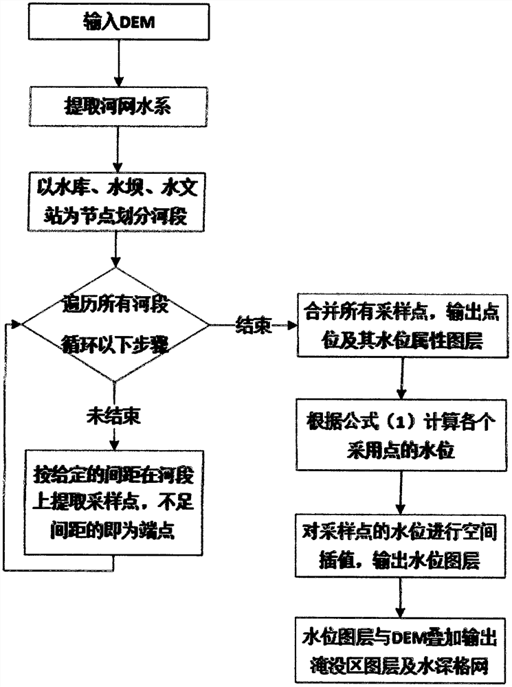
[0018] The DEM-based passive inundation analysis method of integrated hydraulic gradient and early warning water level includes the following steps:
[0019] S1. Input the DEM, extract the river network water system, and divide the river section with reservoirs, dams, waterfalls, tributary confluence points, and hydrological stations as nodes;
[0020] S2. Extract sampling points on all river sections according to a given interval, and those with less than the interval are endpoints;
[0021] S3, merge all the sampling points extracted, and output the point position and its water level attribute layer;
[0022] S4, through the formula H=h 0 +I*L 0 Calculate the water level at each point of adoption;
[0023] S5, carry out spatial interpolation to the water level of sampling point, output water level layer;
[0024] S6. Overlay the water level layer and DEM to output the submerged area layer and water depth grid.
[0025] The detailed steps are as follows: (1) Data preparatio
PUM
 Abstract
Description
Claims
Application Information
 - R&D Engineer
- R&D Manager
- IP Professional
- Industry Leading Data Capabilities
- Powerful AI technology
- Patent DNA Extraction
Browse by: Latest US Patents, China's latest patents, Technical Efficacy Thesaurus, Application Domain, Technology Topic.
© 2024 PatSnap. All rights reserved.Legal|Privacy policy|Modern Slavery Act Transparency Statement|Sitemap