Network aided terrestrial triangulation using stars (NATTS)

a technology of terrestrial triangulation and network aide, applied in the field of network aided terrestrial triangulation using stars, can solve the problem of increasing insufficient availability of solutions

Active Publication Date: 2006-12-07
GOOGLE LLC
View PDF74 Cites 3 Cited by
  • Summary
  • Abstract
  • Description
  • Claims
  • Application Information

AI Technical Summary

Benefits of technology

This device can help gather valuable assets like pets such as dogs through monitoring their movements on a large area around them. These assets have unique identifiers called tags attached thereto - these markers indicate where they're moving inside space. When someone wants to take action based solely on those assets without actually tracking it themselves, the system uses special equipment placed near certain locations along its route to collect important information about how farthest away objects move towards usable areas.

Problems solved by technology

This patents describes how precise location detection of remotely located equipment depends heavily upon its own technical problem addressed in this patented solution. Specifically, current systems rely solely on astronomers who estimate their altitude based on satellite-based timing measurement alone without considering factors like weather conditions or electronics interference. Additionally, there exist certain existing approaches involving radar tracking but none provide sufficient accuracy due to issues related to electrical noise and atmospheric turbulence.

Method used


Image

  • Network aided terrestrial triangulation using stars (NATTS)
  • Network aided terrestrial triangulation using stars (NATTS)
  • Network aided terrestrial triangulation using stars (NATTS)

Examples


Embodiment Construction

[0042] As a preliminary matter, it will readily be understood by one having ordinary skill in the relevant art (“Ordinary Artisan”) that the present invention has broad utility and application. Furthermore, any embodiment discussed and identified as being “preferred” is considered to be part of a best mode contemplated for carrying out the present invention. Other embodiments also may be discussed for additional illustrative purposes in providing a full and enabling disclosure of the present invention. Moreover, many embodiments, such as adaptations, variations, modifications, and equivalent arrangements, will be implicitly disclosed by the embodiments described herein and fall within the scope of the present invention.

[0043] Accordingly, while the present invention is described herein in detail in relation to one or more embodiments, it is to be understood that this disclosure is illustrative and exemplary of the present invention, and is made merely for the purposes of providing a f


PUM


Abstract

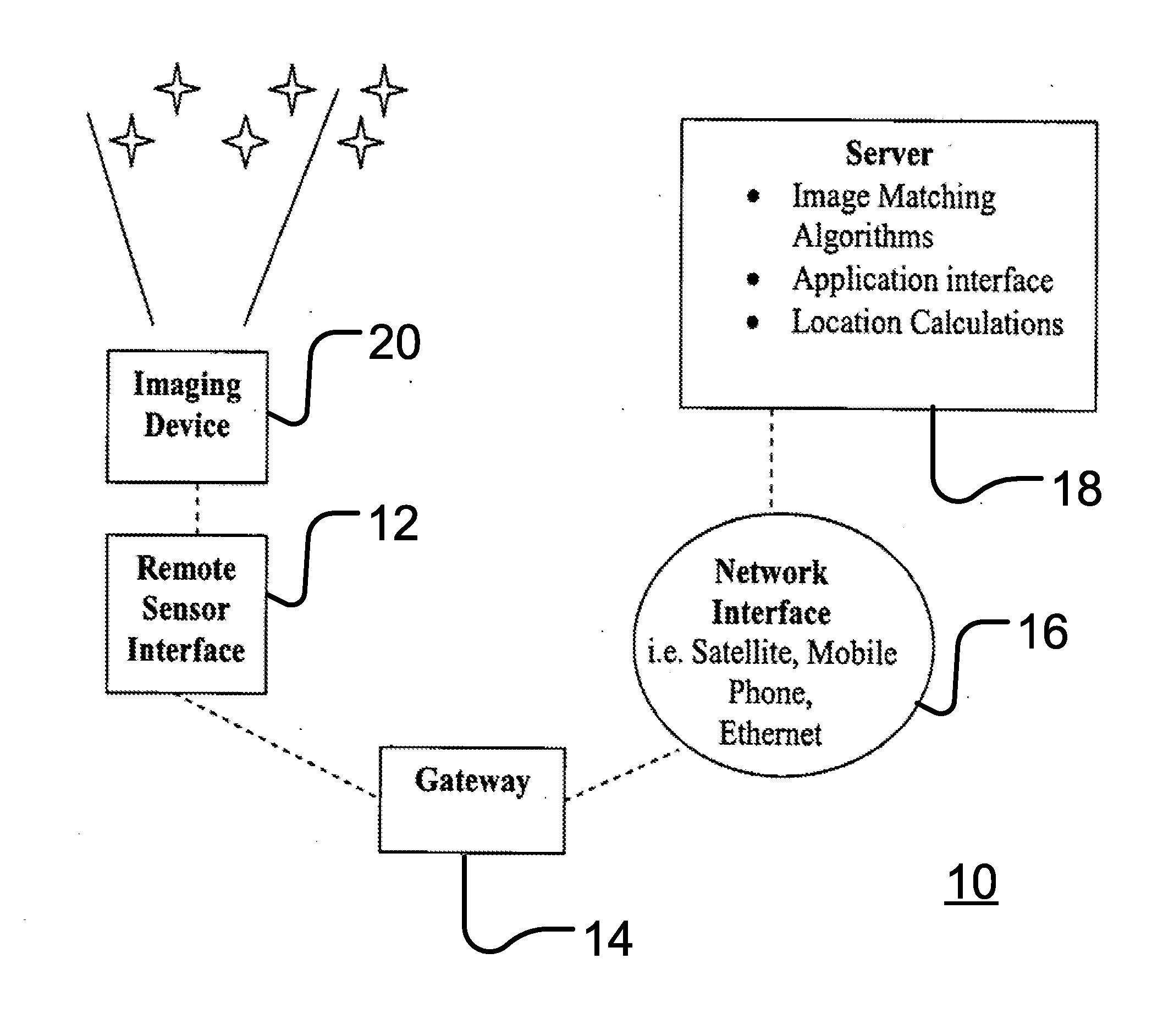
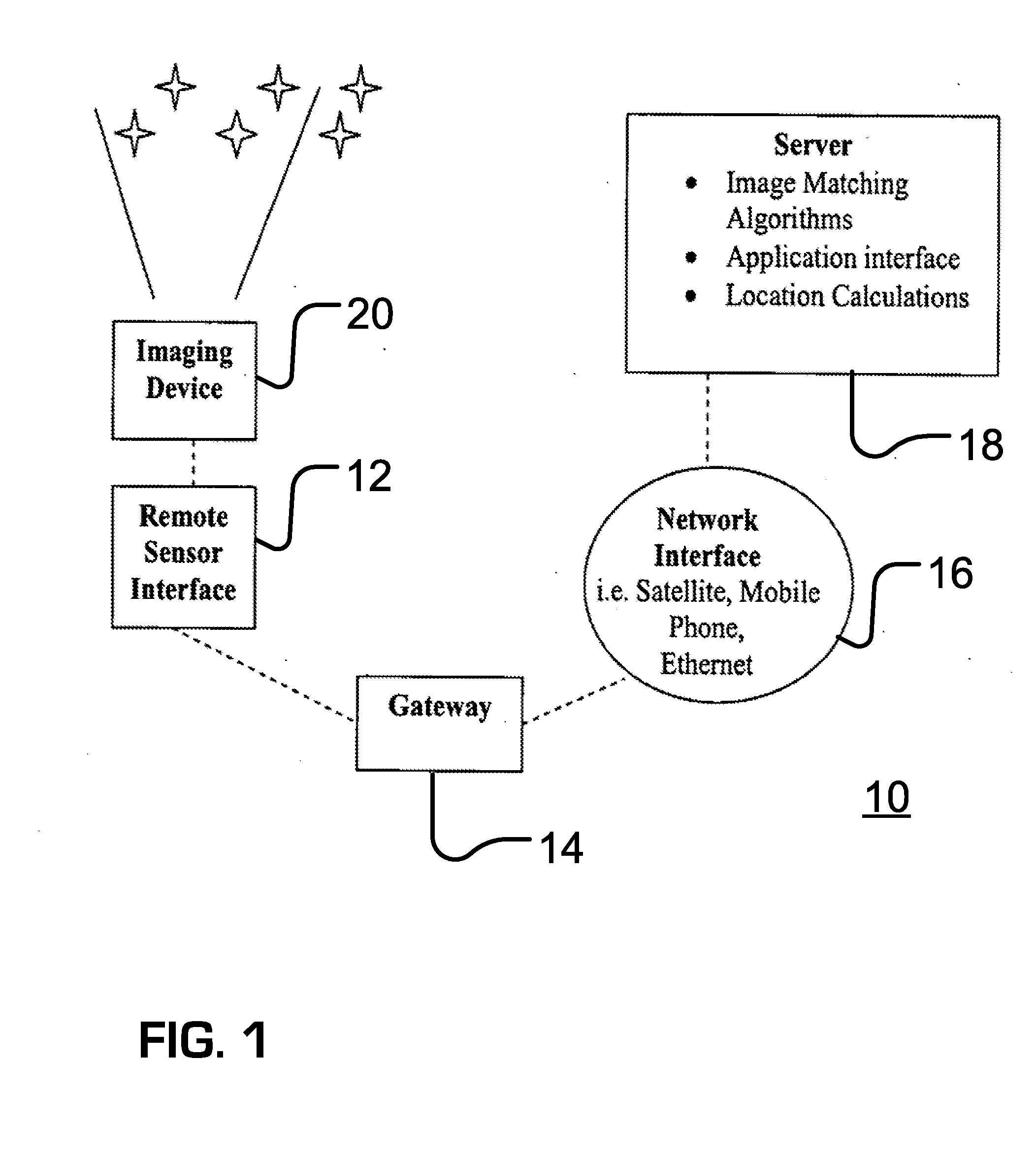
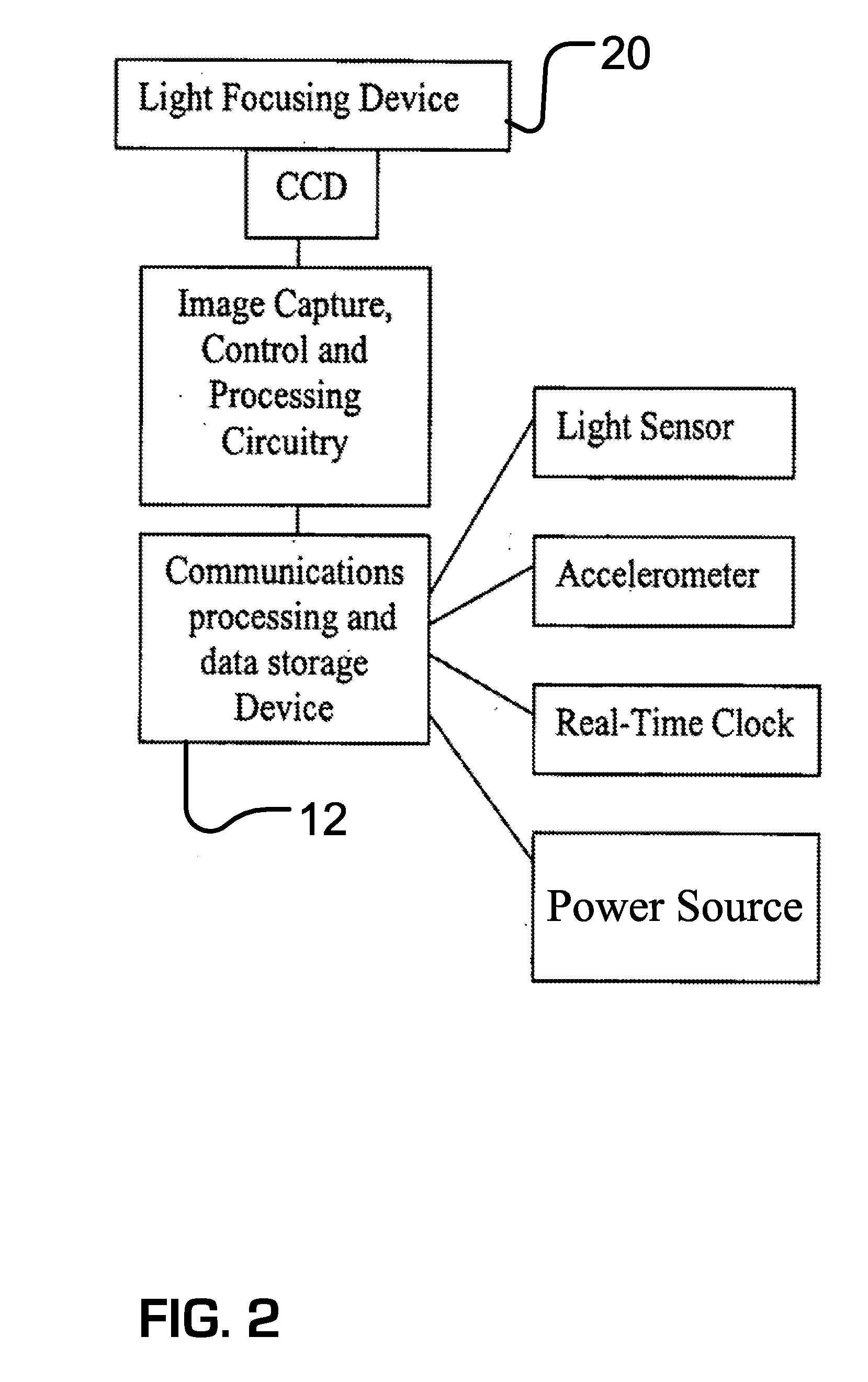
A first apparatus includes an imaging component configured to capture an earthbound image of the sky from a terrestrial location, a chronometric component, a communication component configured to transmit data representative of a captured earthbound image of the sky, and a controller. The controller is configured to cause an earthbound image of the sky to be captured using the imaging component at a time identified by the chronometric component and data representative of the captured earthbound image to be transmitted. A second apparatus includes a computer and a computer readable medium accessible by the computer and including data representative of a master mapping of the sky relative to the Earth and computer-executable instructions for determining a terrestrial location based on data representative of a captured earthbound image of the sky and an identified time at which the earthbound image was captured. A system includes the first and second apparatus.

Description


Claims


Application Information

Patent Timeline
Owner GOOGLE LLC
Why Eureka
Try Eureka