Navigation system realizing enhanced navigation function through camera

A camera and car navigation technology, applied in the field of navigation systems, can solve problems affecting driving safety and driver distraction, and achieve the effects of avoiding distraction, improving driving efficiency and safety

Inactive Publication Date: 2017-10-03
杭州海藻科技服务有限公司
View PDF6 Cites 27 Cited by
  • Summary
  • Abstract
  • Description
  • Claims
  • Application Information

AI Technical Summary

Benefits of technology

This technology helps drivers see their way better without getting into things that might be dangerous or confusing them themselves during long journeys. It also makes it easier than previous methods like displaying map data on screens instead of showing these roads onto paper.

Problems solved by technology

This patented technology allows for more precise directions by showing different levels of detail from what they can see at their own pace when looking down through an icon displayed on your device (the pointer).

Method used


Image

  • Navigation system realizing enhanced navigation function through camera
  • Navigation system realizing enhanced navigation function through camera
  • Navigation system realizing enhanced navigation function through camera

Examples


Embodiment Construction

[0021] Below by embodiment the present invention will be further described, and its purpose is only to understand research content of the present invention better but not limit protection scope of the present invention.

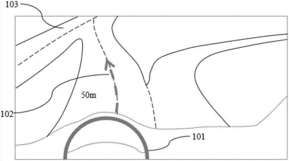
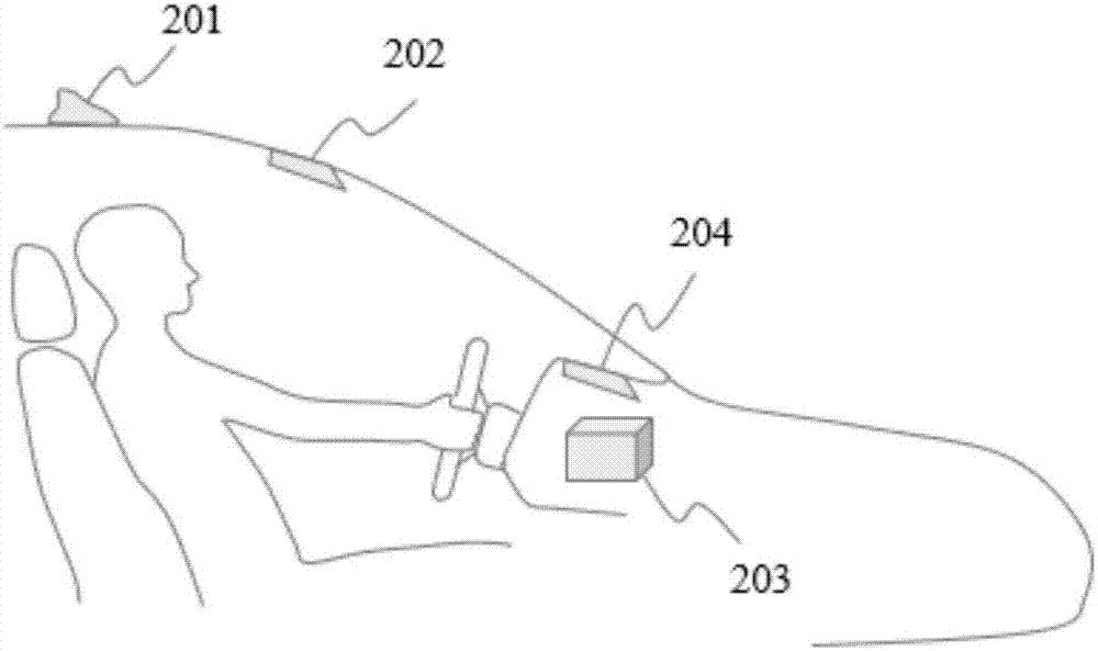
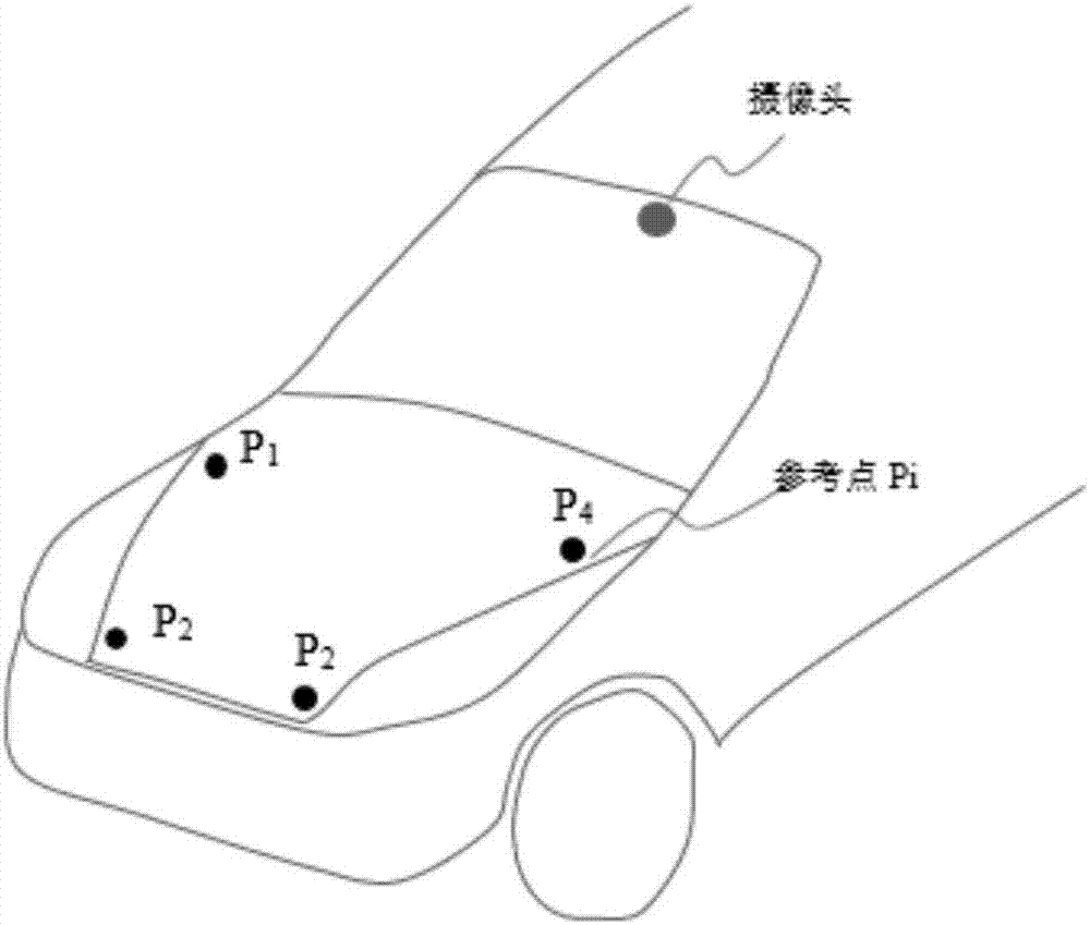
[0022] The navigation system of the present invention that strengthens the navigation function through the camera uses the image recognition technology to collect real-time images of the road ahead through the camera, and performs image recognition on the road surface, and analyzes the shape, curvature, lane, turning angle and radius of the road surface. The slope angle information is used to calculate the road surface model. Then, according to the map data parameters, direction of travel, distance and other data given by the navigation engine, the road surface and lane to be walked are calculated. Then combine the virtual navigation image with the real-time image collected by the camera to provide the most intuitive navigation instructions to the car owner.


PUM


Abstract

The invention provides a vehicle-mounted navigation system. The vehicle-mounted navigation system comprises a vehicle-mounted GPS (Global Positioning System) antenna, a camera, an AR (Augmented Reality) head-up display and a vehicle-mounted navigation host, wherein the vehicle-mounted GPS antenna is used for locating and obtaining a world coordinate system; the camera is used for carrying out real-time image collection on a road condition ahead; the vehicle-mounted navigation host comprises a coordinate system conversion unit which is used for carrying out image recognition and analysis on a road condition image collected by the camera and converting the world coordinate system to a camera image coordinate system, a model generating unit which is used for generating a 3D (Three-dimension) model of a marching road according to the camera image coordinate system, a virtual navigation information generating unit which is used for generating virtual navigation indicating information according to the 3D model of the marching road and an output unit which is used for outputting the virtual navigation indicating information to the AR head-up display; the AR head-up display is used for projecting the virtual navigation indicating information to a windshield and realizing the effect of overlaying the virtual navigation indicating information to an actual road.

Description


Claims


Application Information

Patent Timeline
Owner 杭州海藻科技服务有限公司
Why Eureka
Try Eureka