Remote sensing method for quickly distinguishing silicification zone from acid vein
A technology for silicified zones and acidic rocks, which is applied in the field of remote sensing information technology in structural geological research and mineral exploration, and can solve problems such as the inability to quickly distinguish silicified zones and acidic rock dikes
- Summary
- Abstract
- Description
- Claims
- Application Information
AI Technical Summary
Problems solved by technology
Method used
Image

Examples
Embodiment Construction
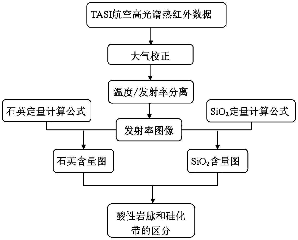
[0036] A remote sensing method for quickly distinguishing silicified zones and acid dikes according to the present invention will be described in detail below in conjunction with the accompanying drawings and examples.
[0037] A remote sensing method for quickly distinguishing silicified zones and acidic dikes of the present invention, firstly preprocesses the thermal infrared hyperspectral remote sensing data; then performs atmospheric correction and emissivity separation to obtain emissivity images; then performs SiO 2 Quantitative calculation of content and quartz mineral content, the SiO 2 Content map and quartz mineral content map; then also high SiO 2 The bands with different quartz content distinguish acid dikes and silicified zones, that is, the ones with high quartz content are silicified zones, and the ones with less quartz content are acidic dikes.
[0038] like figure 1 As shown, a kind of remote sensing method of rapidly distinguishing silicified zone and acid dik
PUM
| Property | Measurement | Unit |
|---|---|---|
| Center wavelength | aaaaa | aaaaa |
Abstract
Description
Claims
Application Information
 - R&D Engineer
- R&D Manager
- IP Professional
- Industry Leading Data Capabilities
- Powerful AI technology
- Patent DNA Extraction
Browse by: Latest US Patents, China's latest patents, Technical Efficacy Thesaurus, Application Domain, Technology Topic.
© 2024 PatSnap. All rights reserved.Legal|Privacy policy|Modern Slavery Act Transparency Statement|Sitemap