Measurement method for actual measurement and laser radar
A measurement method and technology of the area to be measured, applied in the direction of measurement devices, radio wave measurement systems, and the use of re-radiation, can solve the problems of low efficiency, single function, and poor accuracy, so as to improve work efficiency and increase modeling accuracy Effect
- Summary
- Abstract
- Description
- Claims
- Application Information
AI Technical Summary
Problems solved by technology
Method used
Image

Examples
Example Embodiment
[0047] Example 1
[0048] This embodiment provides a laser radar for actual measurement.
[0049] The lidar is used for:
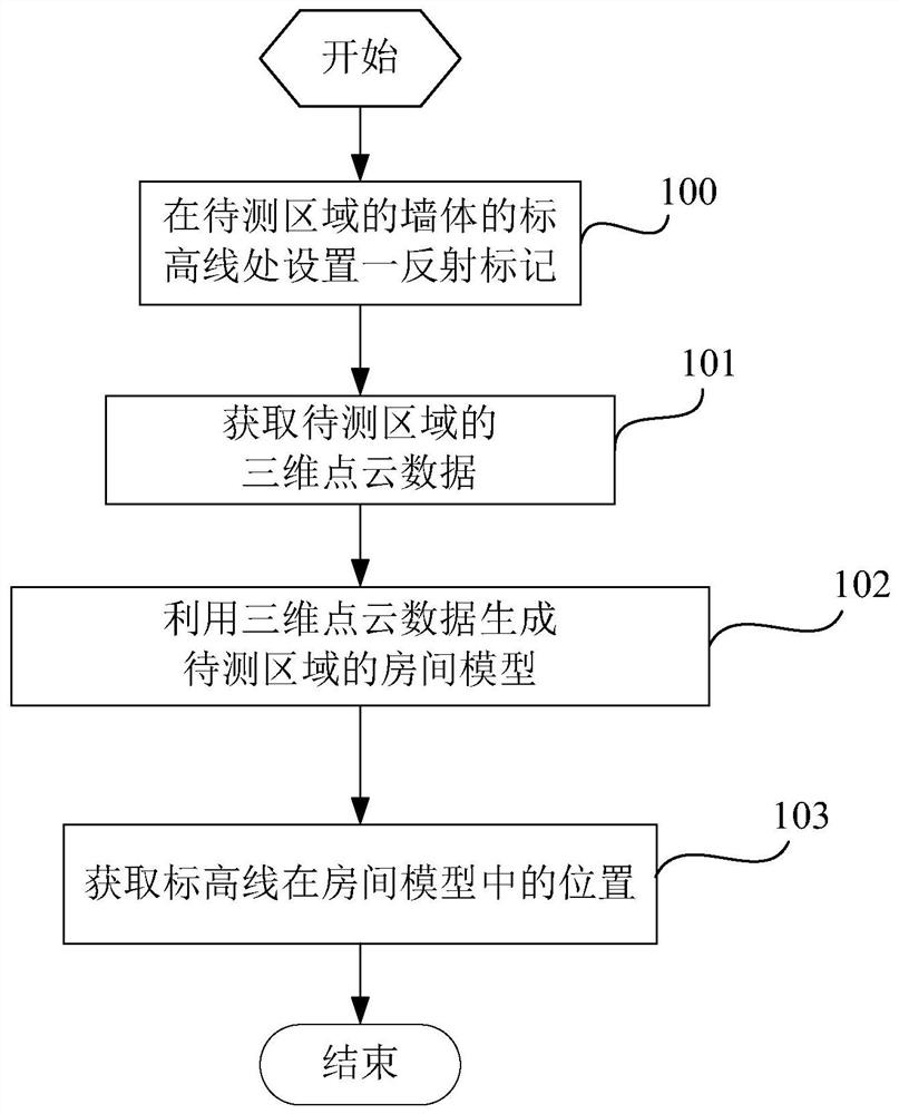
[0050] Scanning the area to be measured to obtain three-dimensional point cloud data of the area to be measured, the three-dimensional point cloud data includes reflectivity, specifically, each point cloud data point includes a reflectivity, wherein the elevation line of the wall of the area to be measured is set a reflective marker;
[0051] The elevation line is usually a one-meter line in a building.
[0052] Use the 3D point cloud data to generate the room model of the area to be tested;
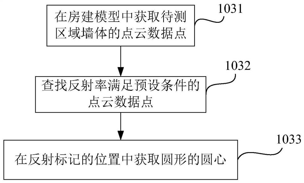
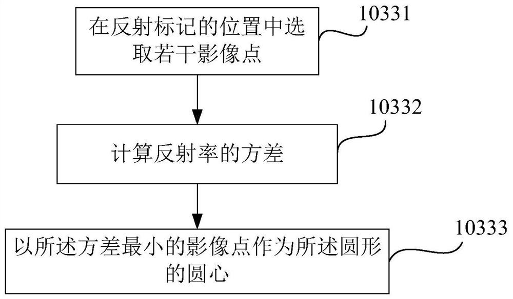
[0053] Find the location of the reflection marker in the room model based on the difference between the reflectivity of the reflection marker and the reflectivity of the wall to obtain the location of the level line in the room model.
[0054] In this embodiment, the reflectivity of the reflective mark is greater than that of the surface of the wall, and the reflect
PUM
 Abstract
Description
Claims
Application Information
 - R&D Engineer
- R&D Manager
- IP Professional
- Industry Leading Data Capabilities
- Powerful AI technology
- Patent DNA Extraction
Browse by: Latest US Patents, China's latest patents, Technical Efficacy Thesaurus, Application Domain, Technology Topic.
© 2024 PatSnap. All rights reserved.Legal|Privacy policy|Modern Slavery Act Transparency Statement|Sitemap