Correction method for updating DEM (digital elevation model) by aid of ground based SAR (synthetic aperture radar)

A calibration method and ground-based technology, applied to radio wave measurement systems, instruments, etc., can solve problems such as inability to make DEM and inability to obtain terrain information

Inactive Publication Date: 2015-03-11
SHENYANG JIANZHU UNIVERSITY
View PDF3 Cites 18 Cited by
  • Summary
  • Abstract
  • Description
  • Claims
  • Application Information

AI Technical Summary

Problems solved by technology

[0005] Aiming at the inability to obtain topographic information from echo signals in the prior art and the inability to make DEM, the technical problem to be solved by the present inve

Method used


Image

  • Correction method for updating DEM (digital elevation model) by aid of ground based SAR (synthetic aperture radar)
  • Correction method for updating DEM (digital elevation model) by aid of ground based SAR (synthetic aperture radar)
  • Correction method for updating DEM (digital elevation model) by aid of ground based SAR (synthetic aperture radar)

Examples


Embodiment Construction

[0056] The present invention will be further elaborated below in conjunction with the accompanying drawings of the description.

[0057] Such as figure 2 Shown, a kind of ground-based SAR of the present invention updates the correction method of DEM, comprises the following steps:

[0058] Step S1: Calculate the SAR magnitude image according to the received ground-based SAR complex domain echo data;

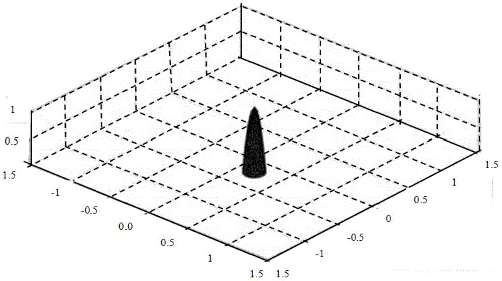
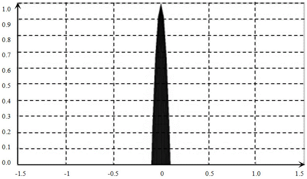
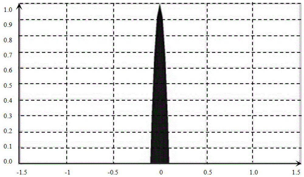
[0059] Step S2: In the above magnitude image, the corner reflector points of the ground-based SAR image are accurately extracted using the elliptical paraboloid model. The expression of the elliptical paraboloid model is:

[0060] ( x - x 0 ) 2 2 p + ( y -


PUM


Abstract

The invention relates to a correction method for updating a DEM (digital elevation model) by the aid of ground based SAR (synthetic aperture radar). The correction method includes computing an amplitude image of the SAR according to received complex-domain echo data of the ground based SAR; extracting corner reflector points of the ground based SAR image; registering the ground based SAR image and an optical image; acquiring ground based SAR image data received by two antenna sensors; respectively correcting phases of the two images; computing coherence of interference patterns of two antennas; unwrapping the phases; computing path difference of corrected slope distance signals and reducing inaccurate measurement errors of base line components B<h> and B<v> of the sensors; completing final elevation calibration work by the aid of ground elevation control points; three-dimensionally superimposing and displaying the ground based SAR image, the optical image and the updated DEM. The correction method has the advantages that approximation is omitted in processing procedures, the optical image and the ground based SAR image can be registered, the DEM can be updated in correction procedures, accordingly, the multi-source data can be precisely corrected, and excellent three-dimensional processing result displaying effects can be realized.

Description


Claims


Application Information

Patent Timeline
Owner SHENYANG JIANZHU UNIVERSITY
Why Eureka
Try Eureka