Mountain landslide disaster monitoring method and system, and image data acquisition device of mountain landslide disaster monitoring system
A technology of image data and acquisition device, applied in measurement device, surveying and navigation, photogrammetry/video survey, etc., can solve the problems of large false alarm rate, single data type, difficult to confirm the scene situation, etc. Low cost, easy to use effect
- Summary
- Abstract
- Description
- Claims
- Application Information
AI Technical Summary
Problems solved by technology
Method used
Image

Examples
no. 1 example
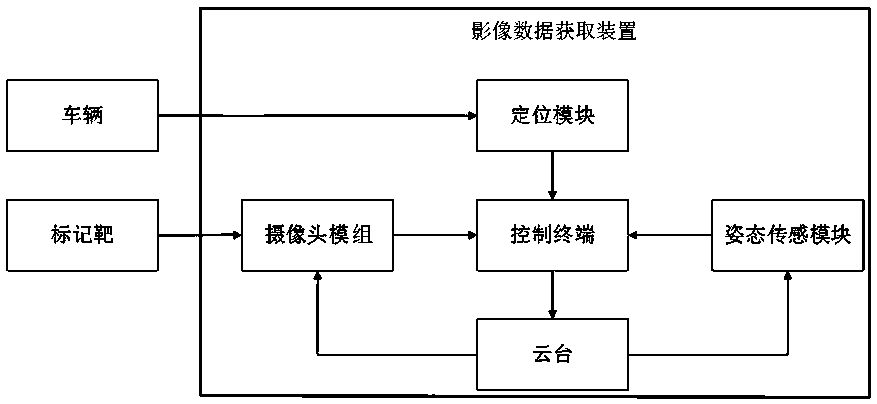
[0054] In order to improve the automation of the monitoring process of landslide hazards, this application also discloses a method of using the above-mentioned image data acquisition device to collect image data of the mountain to be monitored, and analyze the image data to determine whether there is a landslide in the mountain to be monitored. Risk method, the execution subject of this method embodiment is the control terminal, specifically including:
[0055] Step S31: using the above image data acquisition device to collect the current image data of the mountain to be monitored;
[0056] Step S32: Compare the current image data with the original image data stored locally in the control terminal to determine whether the displacement of the marked target position of the mountain to be monitored exceeds the preset threshold range, and if so, send a landslide danger alarm message.
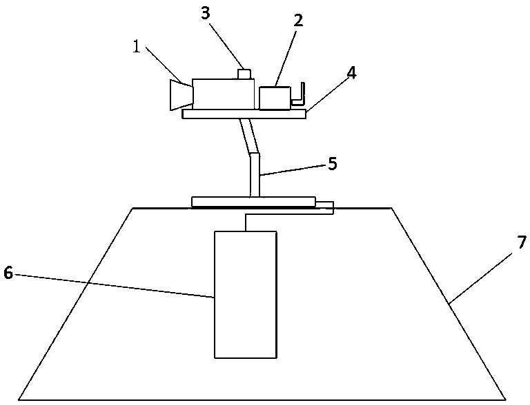
[0057] The first embodiment of the landslide danger monitoring system:
[0058] In order to realiz
no. 2 example
[0062] In order to further improve the automation of the landslide hazard monitoring process, the image data acquisition device configured with the positioning module and / or attitude sensing module can be used to collect image data of the mountain to be monitored. The execution subject of this method embodiment is the control terminal. Specifically include:
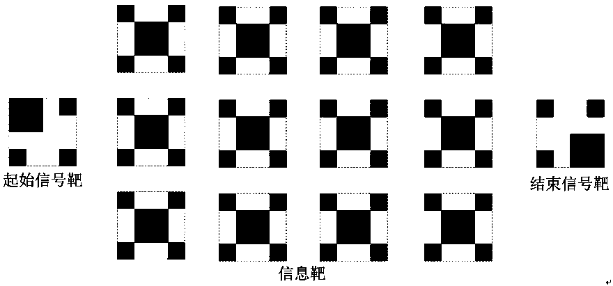
[0063] Step S41: According to the vehicle positioning information obtained by the vehicle control terminal, it is judged whether the vehicle is close to the area where the marked target is located, if so, then control the pan-tilt 4 to automatically rotate to a suitable direction, and search for the initial signal target;
[0064] The implementation of this step S41 is realized based on the overall cooperation of the system, specifically: the storage module of the vehicle-mounted control terminal 6 stores the position information of the location of the marked target. (Generally 300-800 meters according to the actual situat
PUM
 Abstract
Description
Claims
Application Information
 - R&D Engineer
- R&D Manager
- IP Professional
- Industry Leading Data Capabilities
- Powerful AI technology
- Patent DNA Extraction
Browse by: Latest US Patents, China's latest patents, Technical Efficacy Thesaurus, Application Domain, Technology Topic.
© 2024 PatSnap. All rights reserved.Legal|Privacy policy|Modern Slavery Act Transparency Statement|Sitemap