Quick estimation and three-dimensional display method for visual green land areas of city floors
A floor and green space technology, applied in the field of geographic information science virtual reality, can solve the problems of slow data update speed, heavy workload, lack of visual quality of urban green space landscape, etc., and achieve the effect of reducing labor cost and labor cost.
- Summary
- Abstract
- Description
- Claims
- Application Information
AI Technical Summary
Benefits of technology
Problems solved by technology
Method used
Image

Examples
Embodiment
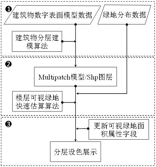
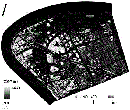
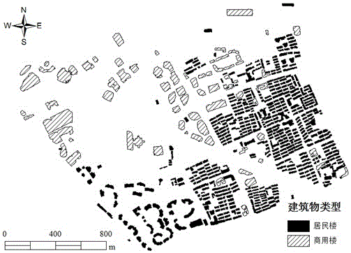
[0049] Refer to figure 1 , Taking the Lujiazui area of Shanghai as the research object, figure 2 The building digital surface model and vegetation distribution data used in this embodiment. The building digital surface model data refers to raster data whose pixel values represent elevation and land use types belong to construction land.
[0050] Step 1: Invoke the building layered modeling algorithm, extract the base contour and automatic 3D modeling of the building digital surface model data, and generate the corresponding Shp layer and Multipatch model.
[0051] Specific operations include:
[0052] i) Base contour extraction: Set the 3.5m elevation threshold T=3.5m according to the municipal planning, use the threshold segmentation method, according to the formula Obtain a binary raster image; then vectorize the binary raster image, that is, through boundary line tracking, remove redundant nodes (Node), organize the raster data into multiple polygons (Polygon) that record the c
PUM
 Abstract
Description
Claims
Application Information
 - R&D Engineer
- R&D Manager
- IP Professional
- Industry Leading Data Capabilities
- Powerful AI technology
- Patent DNA Extraction
Browse by: Latest US Patents, China's latest patents, Technical Efficacy Thesaurus, Application Domain, Technology Topic.
© 2024 PatSnap. All rights reserved.Legal|Privacy policy|Modern Slavery Act Transparency Statement|Sitemap