Water and soil conservation monitoring method and system and computer equipment
A computer program and soil and water technology, applied in the field of soil and water conservation monitoring, can solve problems such as the lag of remote sensing satellite images and the inability to grasp soil and water disturbance in time, and achieve the effect of avoiding soil erosion
- Summary
- Abstract
- Description
- Claims
- Application Information
AI Technical Summary
Benefits of technology
Problems solved by technology
Method used
Image

Examples
Embodiment Construction
[0042] In order to make the objects, technical solutions and advantages of the present application, the present application will be described in detail below with reference to the accompanying drawings and examples. It should be understood that the specific embodiments described herein are intended to explain the present application and is not intended to limit the present application.
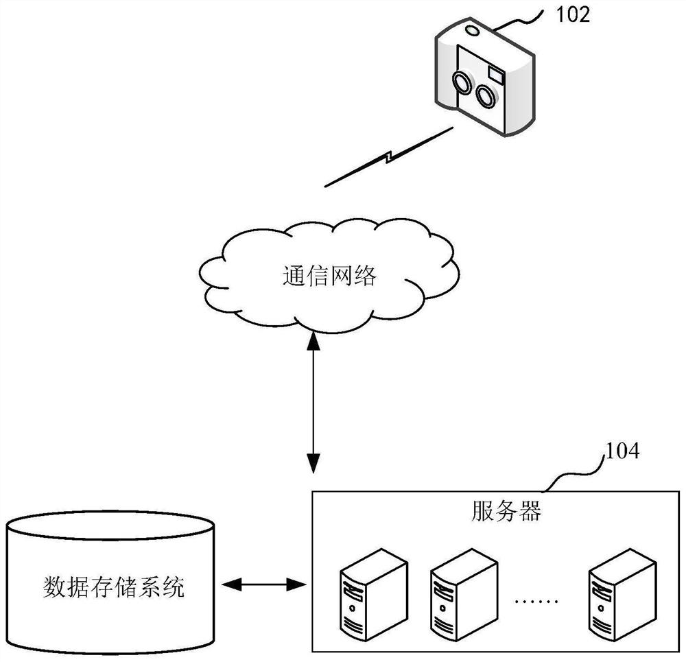
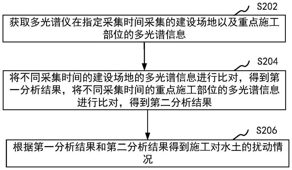
[0043] The method of water and soil maintenance monitoring provided herein can be applied to figure 1 The application environment shown. The multi-spectrometer 102 communicates with the server 104. The communication mode can be anywhere or wireless. In order to collect the soil holdings of the construction site, before the multi-spectral information of the construction site is collected by the multi-spectrometer 102, it is necessary to first put the multi-spectrometer 102 on the flight equipment, and the flight equipment can be implemented according to the preset flight trajectory. The aerial photogr
PUM
 Abstract
Description
Claims
Application Information
 - R&D Engineer
- R&D Manager
- IP Professional
- Industry Leading Data Capabilities
- Powerful AI technology
- Patent DNA Extraction
Browse by: Latest US Patents, China's latest patents, Technical Efficacy Thesaurus, Application Domain, Technology Topic.
© 2024 PatSnap. All rights reserved.Legal|Privacy policy|Modern Slavery Act Transparency Statement|Sitemap